




 A
A
A
A
A
A
Mohammed Jaffal | Ahmad al-Humaidi
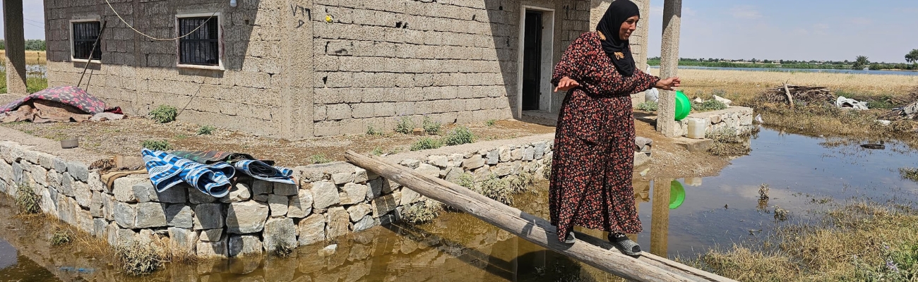
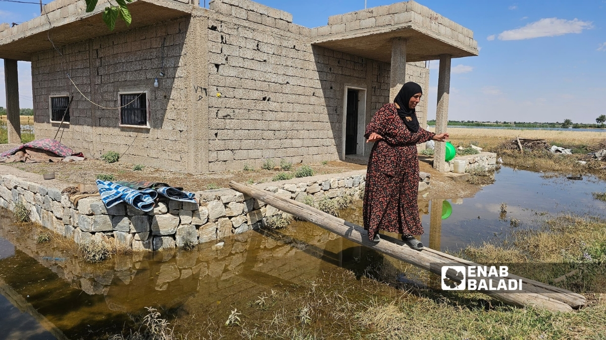
Eight months after returning to the western countryside of Deir Ezzor, eastern Syria, Halima al-Faraj believed that her long years of displacement were nearing an end.
Halima, known among her neighbors as “Umm Hammoud,” was forced by the war to leave her home in Deir Ezzor city. After the fall of the regime, she returned with her family to live in an abandoned house in the village of Ayash, trying with her husband to start over.
They did not have much, a plot of land where they planted summer vegetables and some hope that months of hard work would become a source of income to help the family face the poverty that had accompanied it for years. But what the family had built over a few months began collapsing within days.
As the Euphrates River level rose and water reached land near its course, floodwaters submerged the vegetable fields that represented the family’s only source of income.
“How difficult it is to see the labor and effort of months disappear within hours without being able to do anything,” Umm Hammoud told Enab Baladi.
As the water spread, the family did not only lose its crop, but found itself trapped in the area with no ability to move elsewhere, since it had no alternative shelter to turn to.
Hundreds of kilometers to the north, farmer Bashir al-Hassan was watching the same scene from Hawijat Hamra Ghannam in eastern Raqqa countryside.
For days, the man in his sixties has been waiting for the water level to recede so he can return to his home and land, which the Euphrates flooded after the water swept through fields and homes along the river’s left bank.
Bashir said he had not seen a similar rise in the Euphrates level for decades, adding that the loss he suffered “cannot be compensated at any price,” after he lost dozens of dunams planted with cotton and vegetables, as well as furniture and belongings he left behind when the water reached his home.
Water Swallows Livelihoods and Dreams
Crisis Revives Questions Over Euphrates Management
Between the village of Ayash in western Deir Ezzor countryside and Hawijat Hamra Ghannam in eastern Raqqa countryside, the same scenes were repeated along both banks of the Euphrates. Families evacuated their homes in haste, farmers watched the water swallow fields they were preparing to harvest, and livestock owners moved their herds to higher ground, while roads and crossings that formed the daily lifeline for dozens of villages and population clusters near the river were cut off.
What Raqqa and Deir Ezzor witnessed was not merely a passing seasonal flood. It was an event that revived old questions about managing the Euphrates River and Syrians’ relationship with it. After years of drought, declining water inflows, and a sharp drop in levels, the recent rise revealed another face of the river, one that brought direct losses to those affected, but also opened a wider debate over managing water resources and dams, the level of coordination among basin countries, and the readiness of areas along both banks of the Euphrates to deal with sudden changes in water flows.

Residents move their livestock from Hawijat Hamra Ghannam, eastern Raqqa countryside, fearing it could drown, May 27, 2026. (Enab Baladi/Ahmad al-Humaidi)
Damage Extends From Homes to Infrastructure
The repercussions of the rising Euphrates level were not limited to farmers and residents living near the riverbanks. They extended to vital sectors in Raqqa and Deir Ezzor, amid what local bodies describe as the largest wave of rising water levels the area has seen in decades.
In Deir Ezzor, the water fully or partially submerged more than 500 homes in villages and towns adjacent to the river strip, including Ayash, al-Kasrah, Hawijat Saqr, Hawijat Kati, Hatla, Khasham, Mrat, Hajin, Abu Hamam, al-Gharanij, and Sbeikhan. The water also reached parts of the Corniche Street in Deir Ezzor city and large areas of Hawijat Saqr, where the number of damaged homes alone exceeded 100.
Human Losses and Rescue Scenes
The floods were accompanied by human losses, as drowning cases were recorded in several areas of the governorate after water rushed into populated areas and residents approached the river course during the period of rising levels.
According to preliminary data, flood-related incidents led to the deaths of seven children and two young men in separate areas of Deir Ezzor, including Zaghir Jazira, al-Kharita, Mrat, al-Kasrah, Sweidan, al-Susah, and Deir Ezzor city.
As the water spread, Civil Defense teams and naval forces intensified evacuation and rescue operations, particularly in areas that became surrounded by water or where land access routes were cut off.
Water, Bridges, and Infrastructure Crisis
The repercussions did not stop at residential damage and human losses, but also affected infrastructure and basic services linked to residents’ daily lives.
In Deir Ezzor, 84 drinking water pumping stations went out of service, either because they were submerged or as a precautionary measure to protect them, raising fears of disruptions to drinking water provision and contamination of some water sources.
The transport network between the two riverbanks was also damaged after several earthen and floating bridges went out of service, including the earthen bridge in Deir Ezzor city, the Hawijat Saqr bridge, the earthen bridge in al-Mayadin, and the floating bridge in al-Mariyah. This forced residents to rely on local boats and ferries to move and transport basic needs between the Jazira and Shamiya areas.
In Raqqa, the effects of the flood appeared less severe for drinking water services compared with Deir Ezzor, but they affected several vital facilities along the river course.
According to the Drinking Water Directorate, 15 out of 86 stations in the governorate were damaged, in addition to two horizontal stations affected by the rising levels.
However, technical teams were able to return most stations to service in the following days. Only three stations remained out of service because water islands had formed within the riverbed and water levels around them remained unstable, while the Water Resources Directorate confirmed that irrigation stations had not sustained permanent damage.
The broader losses, however, were recorded in the agricultural sector, which is the main source of income for thousands of families on both banks of the Euphrates.
In Deir Ezzor, the water submerged 20,534 dunams of agricultural land, according to the Emergency Response Committee.
The damage included wheat fields and summer crops, as well as the sinking of hundreds of pumping engines and the shutdown of several agricultural associations after water reached engine rooms.
In Raqqa, initial estimates showed damage to around 2,000 dunams planted with wheat and barley, along with damage to 120 agricultural engines and ten fish farms, in addition to varying damage to orchards and fruit trees spread along the river course.
This means the damaged agricultural areas in the two governorates exceed 22,000 dunams, according to preliminary statistics.
Although part of the losses caused by the flood has become clear, the final picture of the damage is still taking shape as field surveys continue in affected areas.
Available data indicate that the effects of the rising levels went beyond homes and agricultural land to include water networks, transport routes, and service facilities, while specialized committees continue assessing and documenting damage in preparation for more accurate estimates of the losses sustained by residents and productive sectors along both banks of the Euphrates.
Emergency Response to Contain the Flood’s Impact
As the affected areas expanded, Syrian authorities and local bodies deployed teams to areas along the Euphrates banks to carry out evacuation and rescue operations and secure basic needs for residents.
In Deir Ezzor, three temporary shelter centers were established and received around 350 families evacuated from villages and areas submerged by water, while other families preferred to move to relatives’ homes or safer areas inside the city and its countryside.
Civil Defense teams and naval forces participated in transporting residents and humanitarian cases by boats, especially after a number of bridges and crossings went out of service.
Technical workshops and local bodies also built earthen berms at some threatened locations and evacuated several water stations and facilities near the river course to protect them from inundation, in parallel with efforts to maintain basic services and reduce the impact of service interruptions on residents.
These measures were accompanied by the dispatch of urgent aid and supplies to affected areas, including quantities of flour, medical supplies, and shelter center equipment. As water levels gradually receded in recent days, technical teams began assessing damage and rehabilitating affected facilities.
In this context, 22 water stations in Deir Ezzor countryside were restarted in recent days, while the concerned authorities continue working to return the remaining stations and bridges to service, in a phase local officials describe as no less important than the phase of confronting the flood itself.
But the damage left by the flood was only the visible face of a larger event that goes beyond Raqqa and Deir Ezzor.
Over the past years, the Euphrates in Syria has been associated with declining levels, reduced water inflows, and shrinking agricultural areas. Suddenly, residents found themselves facing the exact opposite scene, dam lakes nearing capacity, unprecedented water inflows, and water flowing in quantities that pushed dam operators to open spillway gates for the first time in decades.
This rapid shift brought back questions about the river’s importance to Syria, the mechanism for managing its resources, the nature of the water relationship between Damascus, Ankara, and Baghdad, and the readiness of water infrastructure to deal with fluctuations that have become more severe because of climate change.

Euphrates floodwaters inundate the main street in Hawijat Saqr, Deir Ezzor countryside, May 30, 2026. (Enab Baladi/Jassem al-Abdullah)
The Euphrates, Syria’s Water and Energy Artery
The Euphrates River is the basic pillar of water security in Syria, as millions of residents depend on it for drinking water, irrigation, and electricity generation.
Khaled Hamdawi, assistant director general of the General Establishment of the Euphrates Dam, described the river as “the most important water artery in Syria,” given its role in securing a large share of drinking water needs, supporting the irrigation of hundreds of thousands of agricultural hectares, and serving as the country’s main source of hydropower.
The Euphrates’ importance goes beyond direct services, as it is linked to a large part of Syria’s food security and the stability of local communities in Raqqa, Deir Ezzor, and Aleppo.
The Euphrates gains additional importance given Syria’s growing dependence on transboundary water resources.
Ayman al-Desouki, senior researcher at the Omran Center for Studies, said the river represents around 40% of Syria’s total available water resources, while the country’s water dependency rate reaches around 75%, meaning that most Syrian water resources come from outside its borders.
According to al-Desouki, any sudden decrease or increase in Euphrates flows does not affect the water sector alone, but extends to agriculture, food security, and population stability, as happened during recent drought years that saw a decline in cultivated areas and rising economic pressures on local communities in the eastern region.
Dams, One System for Managing Water and Energy
Syria manages this vital resource through a system of three main dams built along the Euphrates course, Tishreen Dam in the north of the country, the Euphrates Dam in al-Tabqa, and al-Hurriya Dam, formerly al-Baath Dam.
The functions of these dams vary in terms of storage, generation, and regulation, but they operate within an interconnected network aimed at managing water flows and securing drinking, irrigation, and energy needs.
The Euphrates Dam is the largest of these dams, with reservoir storage capacity of around 11.7 billion cubic meters. Tishreen Dam was built to boost electricity production and regulate inflows coming from the north, while al-Hurriya Dam plays a regulatory role in controlling water released from the Euphrates Dam before it reaches downstream areas.
Climate change adviser Youssef Muslimani said the three dams do not only play a storage role, but operate as an integrated system to regulate water flows between periods of abundance and scarcity.
During seasons of high inflows, water is stored in lakes to reduce pressure on the river course, while it is gradually released during drought periods to support irrigation, secure drinking water, and operate electricity turbines.
Spillway gates and turbine gates also form a key tool for controlling flood waves and protecting dams and facilities along the river from risks caused by high flows. In fact, Syrian dams can pass 2,200 to 2,500 cubic meters per second through turbines without the need to open spillways.
The Euphrates River is the most important water artery in Syria, as it represents about 40% of the total available water resources in Syria and forms the main lifeline for residents of the eastern region in drinking water and agriculture.
Ayman al-Desouki
Senior researcher at the Omran Center for Studies
Displacement from Hawijat Saqr, Deir Ezzor countryside, because of the rising Euphrates River level and water flooding homes, May 30, 2026. (Enab Baladi/Jassem al-Abdullah)

How Did Years of Drought Turn Into a Flood?
The rise in Euphrates levels was not the result of one factor, but rather the outcome of several hydrological and climate variables coinciding at the same time.
According to the General Establishment of the Euphrates Dam and water experts, the upper river basin witnessed heavy rainfall over the past months that exceeded usual averages, coinciding with the melting of large quantities of snow in the source areas inside Turkey within a short period. This increased surface runoff and raised water inflows toward Syrian territory.
At the same time, water releases from Turkish dams helped push these inflows to exceptional levels Syria had not seen in decades.
Incoming flows to Syria reached around 2,000 cubic meters per second, according to Khaled Hamdawi, assistant director general of the General Establishment of the Euphrates Dam. These quantities far exceed the levels Syrian dams had become accustomed to receiving in recent years, which were marked by drought and declining inflows.
As a result, lake levels rose to near full capacity, with storage in the dam system reaching around 97%, forcing operators to take exceptional measures to preserve the safety of water facilities and absorb the incoming quantities.
Under these conditions, dam management opened the spillway gates at the Euphrates Dam to discharge part of the excess water and reduce pressure on the dam body, in a step specialists described as unprecedented in more than three decades.
Climate change adviser Youssef Muslimani said opening the spillway is a normal flood management measure when lakes approach their upper operating limits. However, the coincidence of high flows with the presence of population clusters and agricultural land inside flood zones doubled the scale of damage seen in Raqqa and Deir Ezzor.
Did the Euphrates Really Overflow Its Boundaries?
Despite the scenes that accompanied the rising levels and the flooding of homes and agricultural land along the river course, Maan Daoud, professor of infrastructure and services at the Higher Institute for Regional Planning at Damascus University, believes the Euphrates did not actually overflow its natural boundaries, but returned to the floodplain that has historically formed part of its hydrological system.
Daoud said the river has known boundaries that include its bed, river islands, and associated edges, and that major floods that recur every several decades are part of its natural behavior. However, long years of drought and war pushed residents to treat parts of the floodplain as stable land that could be invested in or built on. This made the water’s return appear as though the river had left its course, while in reality it was returning to the area it had historically occupied.
Did the Recent Releases Expose Gaps in River Management?
As the flood wave gradually receded, questions emerged about the level of coordination among basin countries and mechanisms for exchanging information related to water flows.
While the General Establishment of the Euphrates Dam attributed the major rise in inflows to the coincidence of water releases from the Turkish side with snowmelt and heavy rains, Khaled Hamdawi, the establishment’s assistant director general, acknowledged that advance warning levels saw some delay because these large water quantities and the sudden rise in lake levels in source countries had not been expected. He noted that technical data exchange related to water inflows had remained limited in recent years before attempts began to strengthen cooperation and coordination again.
Researcher Ayman al-Desouki believes what happened cannot be separated from the legal and institutional framework governing Euphrates water management, considering that the recent releases revealed gaps in warning and coordination mechanisms among riparian states.
He added that existing agreements do not include sufficient details on managing exceptional situations, such as flood waves or sudden changes in water discharge, leaving wide room for operational discretion and limiting the ability of the various parties to prepare in advance for unusual flows.
Old Agreements for a Renewed File
The framework governing the sharing of Euphrates waters among basin countries dates back to a series of agreements and understandings concluded over past decades.
The 1987 agreement between Syria and Turkey is the most prominent of these understandings, under which Ankara committed to passing a minimum amount of water into Syrian territory, while the 1990 agreement between Syria and Iraq regulated the mechanism for sharing water arriving to the two countries.
However, these arrangements were bilateral in form and did not develop into a comprehensive agreement bringing the three countries together under a unified legal framework for river management.
According to researcher Ayman al-Desouki, the problem does not lie in the existence of the agreements themselves as much as in the limited nature of their executive tools and the absence of clear mechanisms for enforcement, dispute resolution, and technical data exchange related to releases, spillways, and emergency management.
He believes the climate shifts the region is witnessing, alongside the major expansion in dam projects and water uses, make it necessary to reconsider existing frameworks and develop them in line with the nature of current challenges.
The memorandum of understanding signed between Syria and Turkey in 1987 stipulates Ankara’s commitment to passing an average flow of no less than 500 cubic meters per second at the Syrian border. In 1990, Syria and Iraq agreed to divide incoming water, with 58% for Iraq and 42% for Syria. Although these understandings formed the framework governing the water relationship among the three countries for decades, experts believe they are no longer sufficient to deal with new challenges linked to climate change and sharp fluctuations in water inflows.
Between Politics and Water
The Euphrates file is not separate from political and economic relations among the countries of the region. The river that secures a large share of Syria’s water needs first passes through Turkish territory before reaching Syria and then Iraq, making the management of its flows directly linked to regional understandings among these countries.
Researcher Ayman al-Desouki believes the positive political climate currently seen in the region could provide an opportunity to reopen discussion on managing shared rivers and move from crisis management toward building permanent cooperation mechanisms that ensure stable water releases and regular information exchange.
But the questions raised by the flood did not stop at water management and relations among basin countries. They also extended to Syria’s interior, where the losses recorded on the riverbanks revived questions about the readiness of infrastructure, protection systems, and response mechanisms for water disasters.

Displacement from Hawijat Saqr in Deir Ezzor countryside after the Euphrates River level rose and floodwaters inundated homes, May 30, 2026. (Enab Baladi/Jassem al-Abdullah)
Mistakes That Preceded the Water
After the Flood, Lessons and Opportunities
As the water began to recede and some facilities returned to work, another question emerged alongside the causes of the flood, why was the damage this large?
For water resources specialist Dr. Safwan Amjad al-Halabi, the losses witnessed in Euphrates areas cannot be explained by natural conditions alone. Human and engineering factors that accumulated over years contributed to amplifying the flood’s effects and turning it into a wide-scale crisis.
Al-Halabi said the decline in periodic maintenance of some water facilities and earthen berms, along with limited drainage network efficiency in some areas, reduced infrastructure’s ability to absorb high flows.
The crisis also revealed gaps in the river protection system, whether because of the aging of some facilities or the failure to update them in line with the climate shifts the region is witnessing and the increase in extreme weather phenomena.
But the most influential factor, according to al-Halabi, is unregulated urban and agricultural expansion inside the river’s flood zones. During the long drought years, agricultural activities and population clusters expanded into areas that had historically been part of the Euphrates’ natural corridor, putting them in direct confrontation with the water when high flows returned.
He believes construction inside natural flood channels turned many locations into high-risk hotspots and increased human and material losses in a way that could have been reduced by protecting the river corridor and enforcing stricter planning controls.
The River’s Memory and Natural Limits
One indirect reason for the worsening impact of the flood, according to Dr. Maan Daoud, is what can be described as the loss of the “river’s memory.” The years of drought that began in the middle of the first decade of this century, along with the changes imposed by the war, altered residents’ perception of the Euphrates’ nature and boundaries, until wide areas of the floodplain came to be treated as dry, permanently stable land.
He said the Euphrates has a memory documented in official water records, as well as in local heritage, popular literature, and narratives that have recorded the relationship between local communities and the river over many decades.
He believes recovering this memory is no less important than engineering projects, because it helps people understand the river’s nature, respect its boundaries, and adapt to its natural cycles between drought and flood.
Encroachments on the river corridor played an important role in amplifying the flood’s impact. After three decades of relative drought, construction and agriculture expanded inside flood zones that had historically been part of the river’s natural course.
Youssef Muslimani
Climate change adviser
A Response That Reduced Losses, but Exposed Gaps
Despite the scale of the damage, al-Halabi believes the response of emergency teams, Civil Defense, and government bodies helped limit larger losses that could have occurred had intervention been delayed.
Evacuation and rescue operations were carried out in several affected areas, shelter centers and urgent aid were secured for residents, in parallel with efforts to protect vital facilities and restart utilities that had gone out of service.
The crisis also exposed logistical and technical challenges still facing Syria’s disaster management system, most notably limited specialized heavy equipment, shortages of water transport in some areas, and difficulty reaching affected villages during the first hours of the crisis.
Al-Halabi also noted that some areas lack detailed and updated emergency plans that can be activated immediately when disasters occur, slowing some response measures in the early stages of the flood.
In this context, the specialist called for establishing a permanent national fund for emergencies and natural disasters, with independent financial allocations that allow it to finance rescue, relief, reconstruction, and compensation for those affected, along with securing strategic reserves of equipment, energy, and basic materials to ensure the continuity of vital services during crises.
From Early Warning to Artificial Intelligence
The debate after the flood is not limited to addressing current damage, but extends to how to avoid its recurrence in the future.
Al-Halabi believes early warning systems represent the first line of defense against floods, but their effectiveness remains linked to the accuracy of data and the speed of its circulation among the concerned parties.
He said the recent Euphrates experience showed the need to develop water and hydrological monitoring networks and establish a modern system based on digital measuring stations distributed along the river and connected to satellites and modern communications systems, allowing real-time data on flows, levels, and hydrological changes.
He also called for adopting a comprehensive national early warning strategy based on continuous monitoring, scientific analysis of data, and immediate warnings, in parallel with training local communities on evacuation plans and rapid response.
He believes artificial intelligence technologies are now capable of creating a qualitative shift in this field by analyzing huge quantities of data and satellite images and predicting flood risks days before they occur. This would allow resources and emergency teams to be directed toward the areas most vulnerable to danger and reduce human and economic losses.
Silt carries large quantities of organic materials and essential nutrients, such as phosphorus, potassium, and nitrogen, making it a natural fertilizer that contributes to renewing soil fertility and reducing the need for chemical fertilizers.
Murad Kara Mustafa
Agricultural adviser and soil and geotechnical engineer
The Other Face of the Flood, Groundwater and Dam Storage
Despite the major losses caused by the recent flood wave, specialists believe the picture is not limited to immediate damage alone. The events that appeared catastrophic for thousands of affected people may also carry positive effects that could benefit the region in the coming years, if they are invested within an integrated vision for water resource management.
Water resources specialist Dr. Safwan Amjad al-Halabi said the high flows witnessed by the Euphrates contributed to strengthening the recharge of underground reservoirs and raising water levels in several wells spread across the river basin, representing an important strategic reserve in facing possible drought waves in the future.
The large quantities of water that entered the Syrian dam system also raised water storage to levels not recorded for years, giving operators greater flexibility in managing drinking and irrigation water during the coming seasons.
Potential gains are not limited to the water side only, as the rise in lake levels is expected to positively affect hydropower production in the main dams located along the Euphrates, especially during periods of high electricity demand in the summer.
The current water abundance may also provide broader opportunities to support the agricultural sector and improve the stability of water supplies for strategic crops that rely mainly on river water.
Al-Halabi believes these conditions may also open the way for programs to rehabilitate wetlands that retreated during the drought years, expand green spaces, and strengthen biodiversity in areas adjacent to the Euphrates.
They could also provide a basis for developing fish farming projects and fisheries, creating additional job opportunities for local communities and supporting the rural economy in eastern Syrian governorates.
Dr. Maan Daoud believes the impact of rising levels is not limited to increasing water storage, but also contributes to activating natural ecosystems, increasing biodiversity, and restoring parts of wetlands that declined during the drought years, giving the Euphrates basin an opportunity to regain part of its ecological balance.

Material losses affected a family in the town of Ayash, western Deir Ezzor countryside, following the Euphrates River flood, June 1, 2026. (Enab Baladi/Jassem al-Abdullah)
Silt, A Treasure Returning With the Flood
Independent agricultural adviser and soil and geotechnical engineer Murad Kara Mustafa described the “silt,” or fine sediment, carried by Euphrates floods as one of the most important natural gains accompanying rising water levels, saying it has historically played a central role in preserving the fertility of agricultural land within the river basin.
According to Kara Mustafa , silt carries large quantities of organic materials and essential nutrients, such as phosphorus, potassium, and nitrogen, making it a natural fertilizer that contributes to renewing soil fertility and reducing the need for chemical fertilizers.
It also helps improve the physical structure of land and increases its ability to retain moisture, an important factor for strategic crops such as wheat, cotton, and vegetables.
He added that floodwaters loaded with silt also help wash away salts accumulated in the soil because of years of drought or intensive irrigation, helping restore its chemical balance and raise its agricultural productivity.
The spread of water also contributes to feeding groundwater basins and supporting the growth of natural vegetation and pastures along the riverbanks, making silt one of the elements directly linked to sustainable agricultural production and food security in the Euphrates basin, despite the losses that may accompany floods in the short term.
What is required is building an integrated national system for managing water and natural disasters, combining scientific planning, modern infrastructure, and effective regional cooperation, in a way that turns the Euphrates River from a source of risk during crises into a basic pillar for development, stability, and water security.
Safwan Amjad al-Halabi
Researcher specializing in water resources affairs
From Crisis Management to Risk Management
For experts, the most important lesson revealed by the recent Euphrates floods is not related to the volume of water that flowed toward Syria as much as to the readiness of institutions and communities to deal with extreme water events. The climate changes the region is witnessing are making long drought periods and sudden flood waves an increasingly present part of the water landscape, imposing a shift from responding after disasters occur to managing risks and preventing them before they happen.
Water resources specialist Dr. Safwan Amjad al-Halabi believes the future of the Euphrates in Syria should be based on a long-term strategic vision that combines infrastructure modernization, strengthened institutional capacities, and improved water resource management.
He said urgent engineering priorities include rehabilitating dams and water facilities, reinforcing riverbanks, developing drainage and protection networks, and updating operating, monitoring, and water control systems in line with the nature of the new challenges imposed by climate change.
These challenges are not limited to Syria’s interior. The future of the Euphrates is also linked to the nature of cooperation among riparian states. The river passes through Turkey, Syria, and Iraq and represents a transboundary water resource, making information exchange and joint coordination an essential part of any successful strategy for its management.
Al-Halabi said sustainable management of the Euphrates requires strengthening water diplomacy and developing mechanisms for immediate and regular hydrological data exchange, along with coordination in operating dams and reservoirs and joint technical cooperation to confront emerging risks.
Building a more effective regional system for exchanging warnings and operational data could also help limit the effects of droughts and floods alike, giving the three countries greater ability to manage this vital resource fairly and safely.
As life gradually returns to the villages and towns swept by the water, the recent Euphrates floods remain one of the most important water events in the river’s modern history, revealing at once the fragility of communities living along its banks and the importance of investing in sustainable water management, early planning, and regional cooperation.
Between the drought that preceded the flood and the water that returned forcefully this year, Syria appears to be facing a new test in its relationship with its most important river and the one with the greatest impact on its water, food, and energy security.
As floodwaters gradually recede, the real challenge remains turning this exceptional event into an opportunity to rethink the management of water and natural resources, before the Euphrates imposes a new test that may come this time in the form of another drought or another flood.

if you think the article contain wrong information or you have additional details Send Correction
النسخة العربية من المقال
-
Follow us :







 More In-Depth